
Wet and stormy Saturday night; cooler week ahead – Nebraska State Climate Office
Wet and stormy Saturday night; cooler week ahead Nebraska State Climate Office
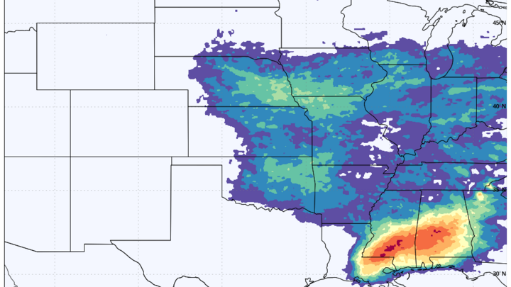
Stormy times aheadThe latest upper level water vapor analysis shows clusters of storms along the Gulf Coast, storms in the southern Plains around a stalled out front, ridging off the Pacific Northwest, and a couple of troughs in the Pacific. The trough currently closest to California will be making its way east over the next 48 hours and a surface low is expected to develop in eastern Colorado by Saturday. By then high surface pressure will be over the southeast, which will pump moisture up from the Gulf back into the Plains. The latest upper level water vapor analysis shows clusters of storms along the Gulf Coast, storms in the southern Plains around a stalled out front, ridging off the Pacific Northwest, and a couple of troughs in the Pacific.
The trough currently closest to California will be making its way east over the next 48 hours and a surface low is expected to develop in eastern Colorado by Saturday. By then high surface pressure will be over the southeast, which will pump moisture up from the Gulf back into the Plains. Winds should be out of the southeast across the state by Saturday afternoon, which means moisture should be getting at least into the eastern Panhandle and western Sand Hills in time for convective initiation on Saturday afternoon. Right
Source & Attribution
This One Place News story was acquired from news.google.com. OPN retains the source link and provenance for newsroom review.
Filed Under
Weather