
Azusa Fire: See Peak Fire Perimeter Map, Evacuation Orders – Patch
Azusa Fire: See Peak Fire Perimeter Map, Evacuation Orders Patch
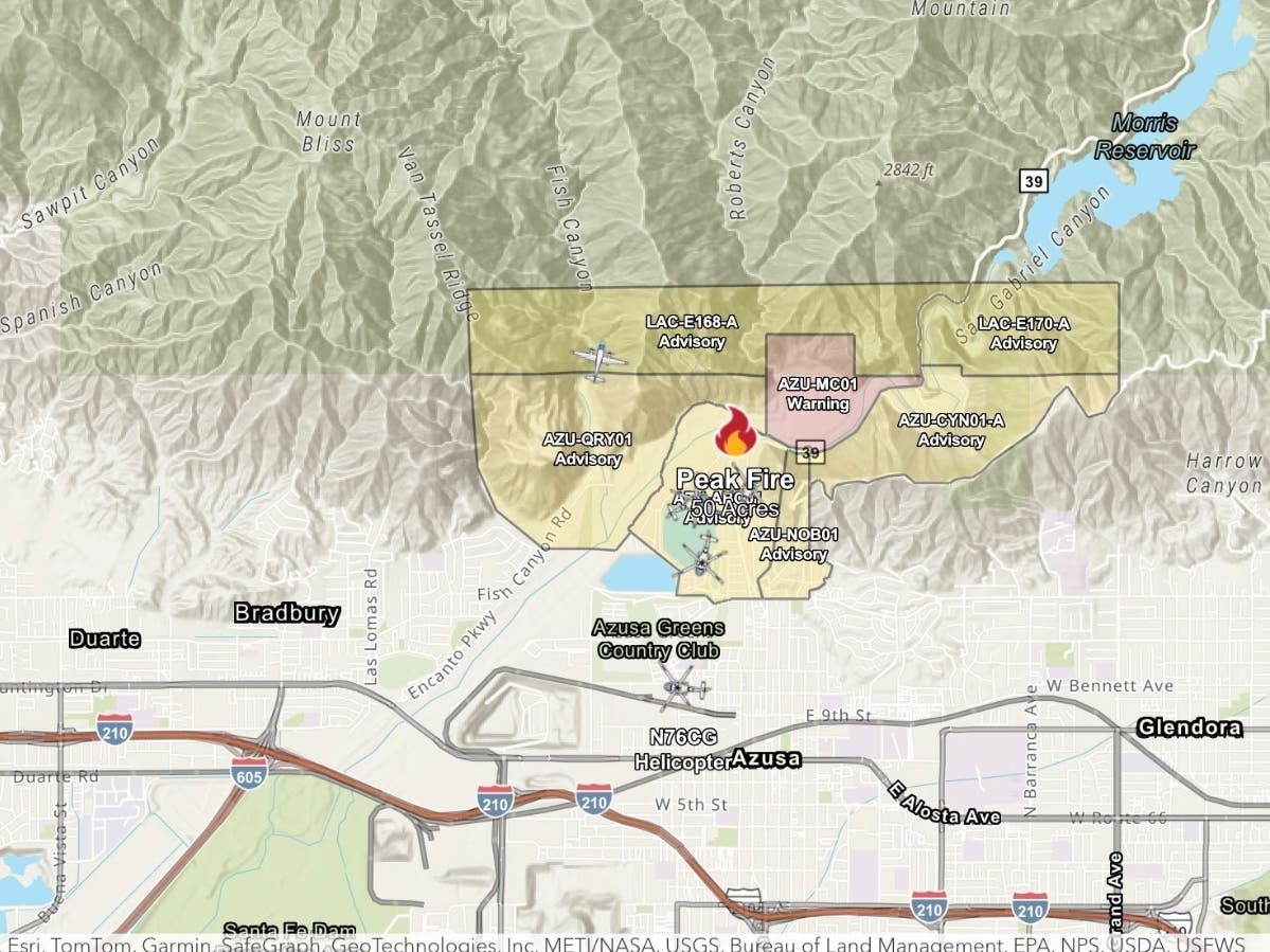
The fire, dubbed the Peak Fire, broke out in the San Gabriel Valley at around 1:15 p.m. Thursday. AZUSA, CA — A wildfire that broke out in Azusa Thursday afternoon quickly grew to an estimated 43 acres, threatening homes and prompting evacuation orders and warnings. The Peak Fire, burning near San Gabriel Canyon Road and Ranch Road in Azusa, broke out at around 1:15 p.m. Thursday, according to the Los Angeles County Fire Department. Firefighters from the Los Angeles County Fire Department and Angeles National Forest responded to the blaze, with helicopters making water drops as crews worked to protect nearby homes.
By Thursday afternoon, the fire had grown to an estimated 43 acres. As of 3 p.m., evacuation orders were in place for zone AZU-MC01. That order was downgraded to a warning shortly thereafter. Evacuation warnings had also been issued earlier for zones AZU-ABC01, AZU-CYN01-A, AZU-NOB01, AZU-QRY01, LAC-E168-A and LAC-E170-A. Those warnings were later canceled. Up-to-date evacuation information, including current orders and warnings, is available on Genasys Protect. An evacuation shelter was opened at 340 N. Orange Ave. in Azusa.
Source & Attribution
This One Place News story was acquired from news.google.com. OPN retains the source link and provenance for newsroom review.
Filed Under
Local News – Los Angeles