
A Texas flood threat is shifting east. When could it reach Houston? – Houston Chronicle
A Texas flood threat is shifting east. When could it reach Houston? Houston Chronicle
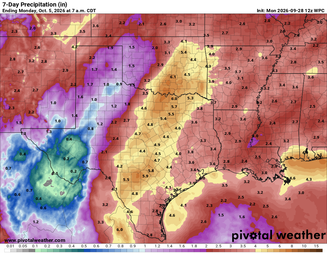
A slow-moving storm system could bring heavy rainfall and flash flooding to parts of Texas this week as remnant moisture from Hurricane Polo in the Pacific Ocean pushes east. Polo itself is not headed for Texas, but its remnant moisture is helping fuel the storm system behind the rain threat. The potential for flooding is expected to shift from the American Southwest toward the southern High Plains and Central Texas before reaching Southeast Texas. Houston’s greatest rain concerns will come Thursday, although the heaviest rainfall currently appears most likely to set up north and west of the region. A small eastward shift could raise the potential for localized flooding around Houston.
Here’s when the threat could reach different parts of the state. Texas flood risk timeline Monday: Heavy rain threatens the desert Southwest The first major concern is across the Four Corners region in the desert Southwest, where widespread rainfall could occur where soil is already near saturation from monsoons. The Weather Prediction Center has placed a level 3 of 4 risk, or at least a 40% chance, of excessive rainfall in parts of New Mexico, northern Arizona, southern Utah and southwestern Colorado. Burn scars, rocky terrain and narrow canyons could worsen flooding, especially in areas hit hard by recent monsoonal flooding. In Texas, Monday’s flood threat is mainly confined
Source & Attribution
This One Place News story was acquired from news.google.com. OPN retains the source link and provenance for newsroom review.
Filed Under
Local News – Houston • Weather