One Place News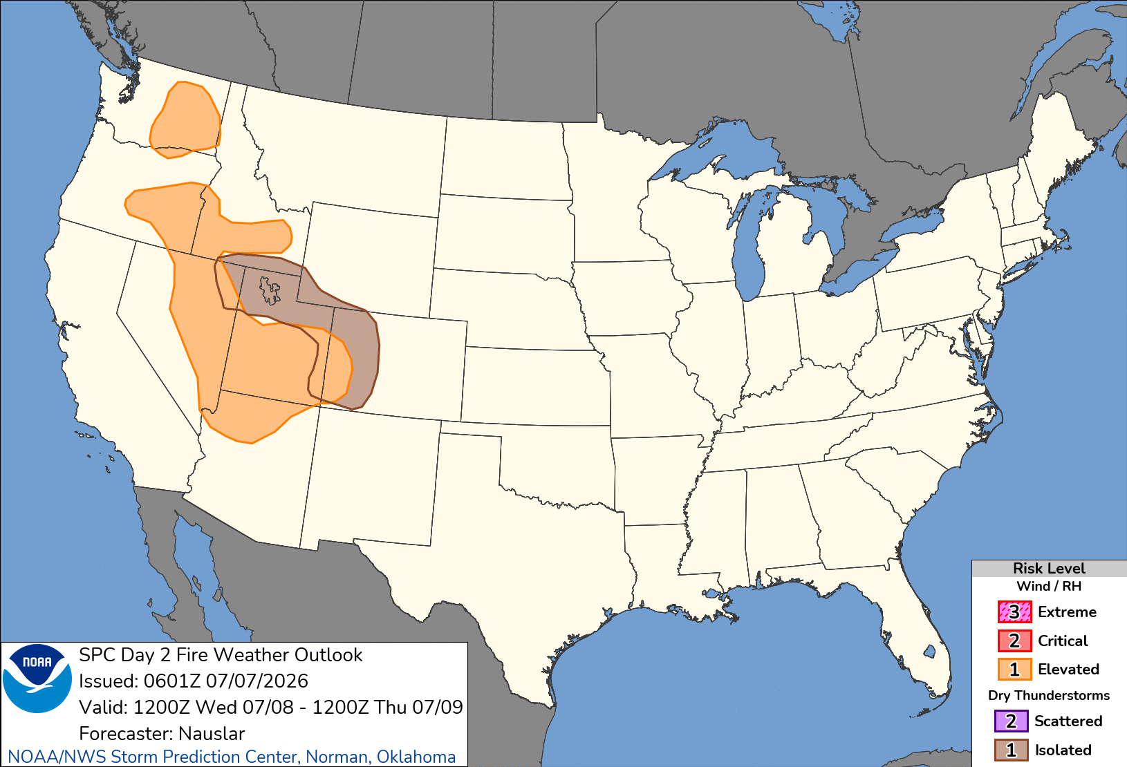
SPC Day 2 Fire Weather Outlook

Day 2 Fire Weather Outlook
NWS Storm Prediction Center Norman OK
0101 AM CDT Tue Jul 07 2026

Valid 081200Z - 091200Z

...Synopsis...
An upper-level trough will move into southwest Canada helping to
flattening the ridge over the West and increasing west/southwest
flow aloft across the northwestern US. The upper high will extend
and shift westward over the southwestern US and off the southern
California coast. A weak, Pacific cold front will move through the
Northwest into the northern Great Basin.

Westerly sustained winds of 12-20 mph with gusts of 20-30 mph amid
minimum RH of 12-25% are likely across portions central/eastern
Washington as the onshore pressure gradient remains enhanced. As the
 Pacific cold front moves southeast, winds will increase along and
ahead of it across much of the Great Basin into the Four Corners.
West-southwest sustained winds of 12-20 mph with gusts of 20-30 mph
amid minimum RH of 5-15% are expected across this area. These dry
and breezy conditions will be following multiple days of lightning
across portions of the Great Basin, with holdovers likely to emerge.

Isolated to scattered mixed wet/dry thunderstorms are likely from
northeast Nevada/southern Idaho extending east-southeast to the West
Slope. This will be on the southern/western periphery of the
residual mid-level moisture that has tracked over the Intermountain
West the past few days. Fuels remain near to record dry across
portions of Utah and Colorado, and multiple large wildfires remain
very active, with a history of pyroCb development in similar
environments.

..Nauslar.. 07/07/2026

...Please see www.spc.noaa.gov/fire for graphic product...