
Hurricane Isaias will bring a heavy rain threat to Middle TN this weekend – WSMV
Hurricane Isaias will bring a heavy rain threat to Middle TN this weekend WSMV
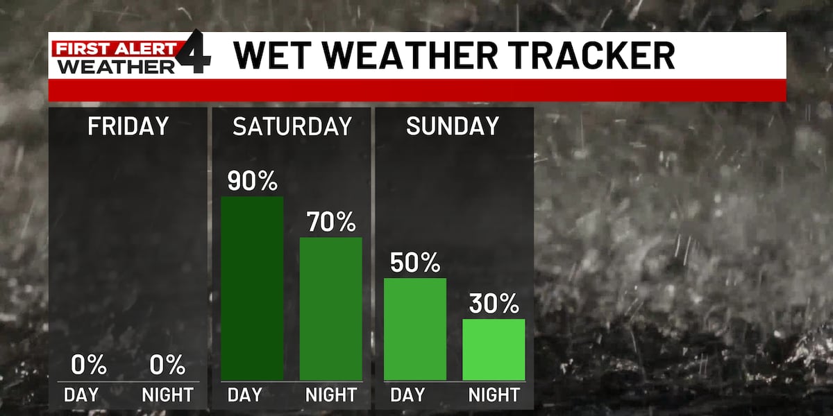
What's left of Isaias will bring impacts to Middle Tennessee this weekend. NASHVILLE, Tenn. (WSMV) – Saturday is a First Alert Weather Day as Hurricane Isaias’ remnants will bring rounds of heavy rain and gusty winds to Middle Tennessee. For life-saving weather alerts, customized messages on conditions and forecasts, and videos detailing upcoming weather events, download the WSMV 4 First Alert Weather app for iPhone or Android. Have weather pictures or videos? Share them here. Saturday is a First Alert Weather Day. Isaias is forecast to reach Middle Tennessee as a tropical depression, bringing rounds of heavy rain and gusty winds.
The storm is currently a Category 1 hurricane with maximum sustained winds above 80 mph. It’s also making history as the latest first hurricane of the Atlantic hurricane season. Evening: Quiet and cool under mostly clear skies. Temperatures fall into the 60s. Morning: Beginning with mostly sunny skies, clouds gradually begin to increase later in the day. Afternoon: Skies becoming partly to mostly cloudy. High temperatures in the upper 80s. Afternoon: Widespread downpours and gusty winds. Heavy rain could cause localized flooding, especially in low-lying and poor-drainage areas. Evening: Showers and gusty conditions may continue before gradually easing.
Source & Attribution
This One Place News story was acquired from news.google.com. OPN retains the source link and provenance for newsroom review.
Filed Under
Local News – Nashville • Weather