
Severe storms possible Wednesday evening followed by cooler temperatures – MPR News
Severe storms possible Wednesday evening followed by cooler temperatures MPR News
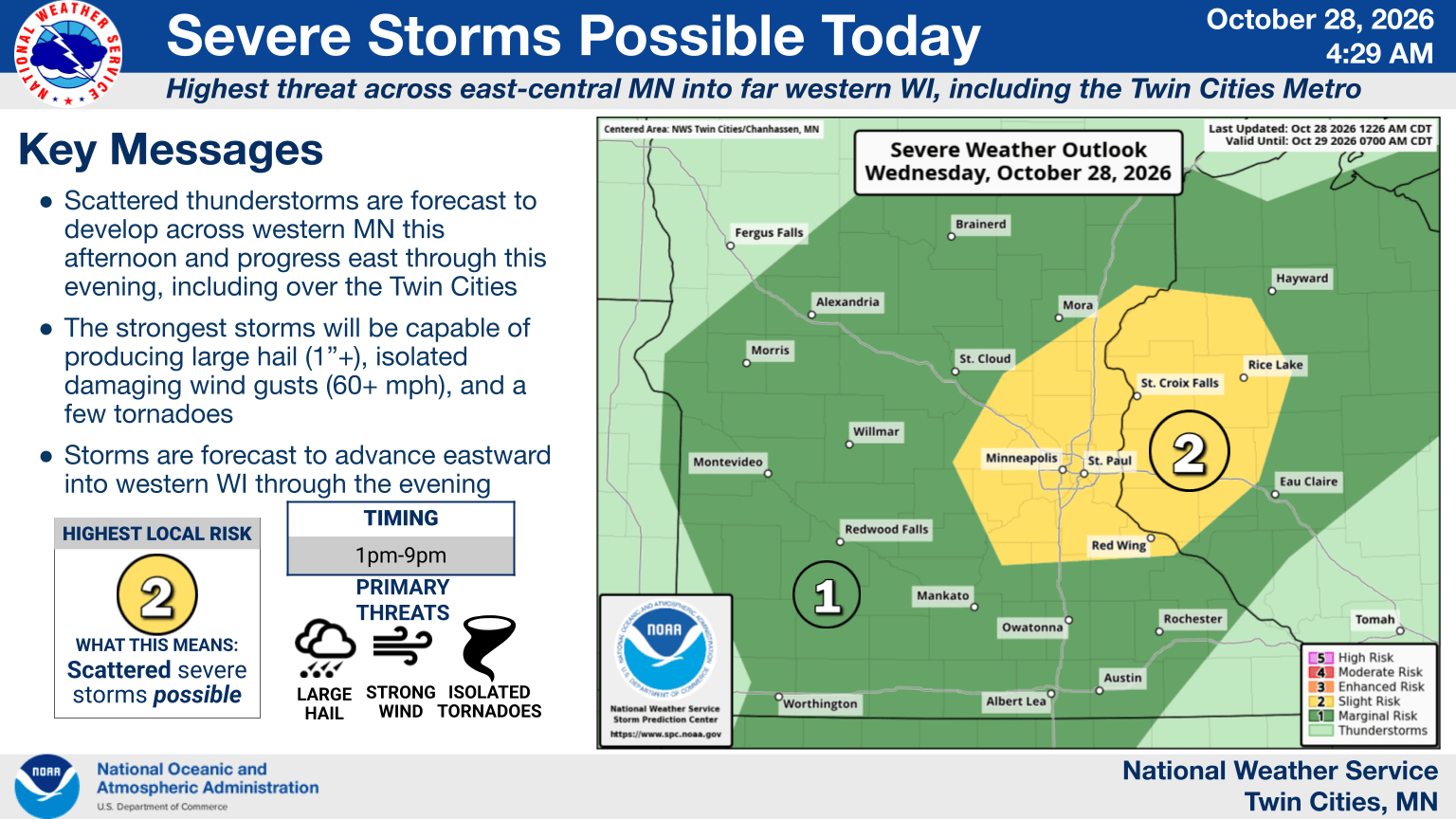
The broad Twin Cities metropolitan region, including all of the suburbs and exurbs, is in the bullseye for potential severe weather Wednesday. That’s the weather highlight all across the U.S. Thanks for liking this story! We have added it to a list of your favorite stories. We are watching for isolated, damaging hail and damaging, straight-line winds Wednesday afternoon and evening — along with a chance of a tornado or two. This is really the only part of the country under a severe weather bulletin for the day. After Wednesday, we get a little bit cooler closer to Halloween, but temperatures remain above average. There are still no big signs of frosty cold weather around southern Minnesota all the way until at least the middle of November.
Even as the sun broke through clouds later Wednesday morning, we were already at the warmest part of the work week. Temperatures were already about 10 degrees above the average high for the day, and I’m sure you felt the humidity if you’ve ventured outside to do a run or grab a coffee. We have really high dew points moving from northern Iowa into south-central and southeastern Minnesota as the day progresses. That gives us moisture, but we also have some sheer, lift and instability. Those four ingredients are something we call S.L.I.M.
Source & Attribution
This One Place News story was acquired from news.google.com. OPN retains the source link and provenance for newsroom review.
Filed Under
Weather